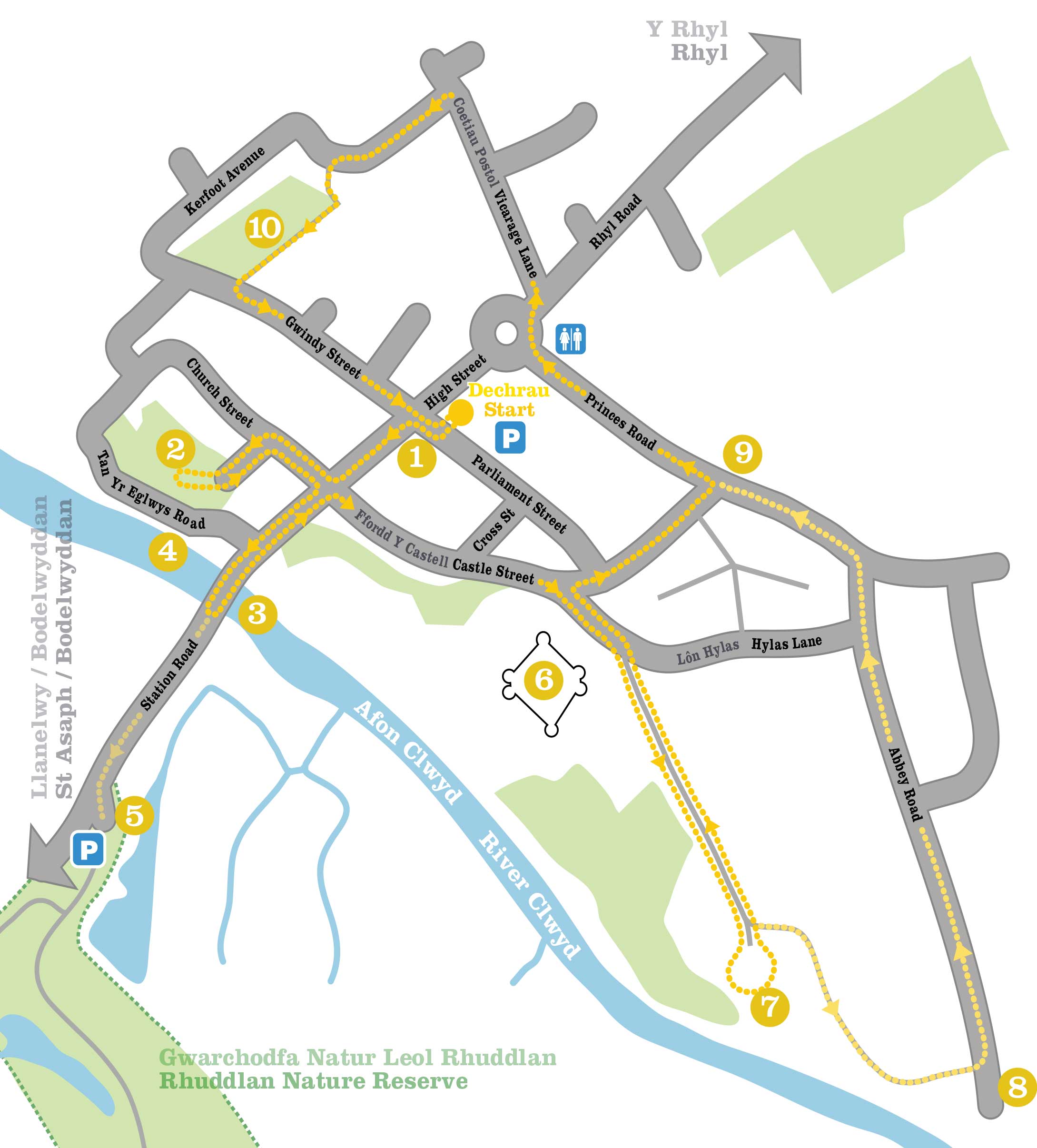
Rhuddlan Town Trail
This strategic spot beside a ford of the River Clwyd, just three miles from the sea, has been a flashpoint in Welsh history since 795AD. It may be a very long time since the Welsh were brutally defeated by the Saxons but the lament “Morfa Rhuddlan” is still sung to this day.
Distance: 2 miles / 3.2 km excluding detours
Difficulty: Easy, path to Twthill can be muddy
Walking time: 2 hours
Start point: Parliament Street car park. LL18 5AL
Public transport: Traveline Cymru 0800 464 0000,
National Rail Enquiries 03457 484950

Parliament House
Parliament House is on the corner of the junction with High Street.
We start with a bit of a red herring. According to the inscription stone, these are the remains of a building in which Edward I passed the hugely significant Statute of Rhuddlan. Unfortunately, despite its name, there is no evidence that this was ever a parliament house – it was most likely a medieval courthouse. The 13th century doorway and 14th century cusped ogee window, both now blocked, probably came from the castle. The Statute itself was real enough – it established English rule over North Wales and lasted for two and a half centuries until the Act of Union in 1536.
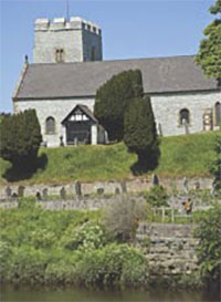
St Mary’s Church
Enter the churchyard through the Victorian lychgate.
This fine parish church was built in about 1300 to serve the new Edwardian town. Two centuries later came the tower and north nave that turned it into a typical double-naved Denbighshire church. A fortified mausoleum for the family of nearby Bodrhyddan Hall was attached to the
north side in 1820 and the church received a thorough Victorian makeover from Sir George Gilbert Scott. Inside you’ll find 17th century Welsh texts painted on the walls and a curious medieval engraved slab depicting the Archbishop of Edessa in Turkey in full regalia.
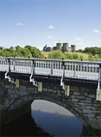
The Bridge
Return to High Street and head downhill to the bridge.
The image of castle, bridge and church all clustered beside the banks of the River Clwyd is so iconic that it was drawn by Turner. Upstream, right beside the water, is the square castle tower that once guarded the port of Edward I. There’s been a bridge here since at least 1277 and this elegant structure, with its twin sandstone arches, dates all the way back to 1595. The cast-iron cantilevered section was added in the 19th century.
The modern footbridge gives the best view of the quays.
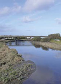
Ancient Quays
It’s hard to believe now that this serene river was once thronged with schooners. A small wooden quay was established in post-medieval times and by the early 19th century it came equipped with a warehouse and loading crane. A stone wharf was built soon after and the port became the most important in North Wales, exporting grain, timber and lead ore from the massive Talargoch mine at nearby Meliden. There was even a foundry and tannery on the western bank. The arrival of the railway in 1848 closed the shipping route and the quays fell into disuse.
Head back up the hill or continue down Station Road for a short detour to the nature reserve.
Rhuddlan
Nature Reserve
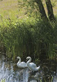
Local people helped turn this forgotten corner south of the river into one of North Wales’s newest nature reserves – and already kingfishers, water voles and otters have moved in. What used to be the railway station is now part of an 11-acre wildlife haven with ponds, woods and wildflower meadow. Look out for the sculptures – hovering dragonflies, a cormorant stretching its wings, even a walker lacing his boots. It’s a wonderful place for a stroll with a great view across the river to the castle. And if you’re feeling really energetic, it’s on National Cycle Route 84 that runs all the way from the coast to St Asaph.
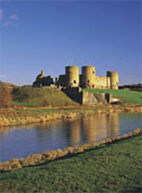
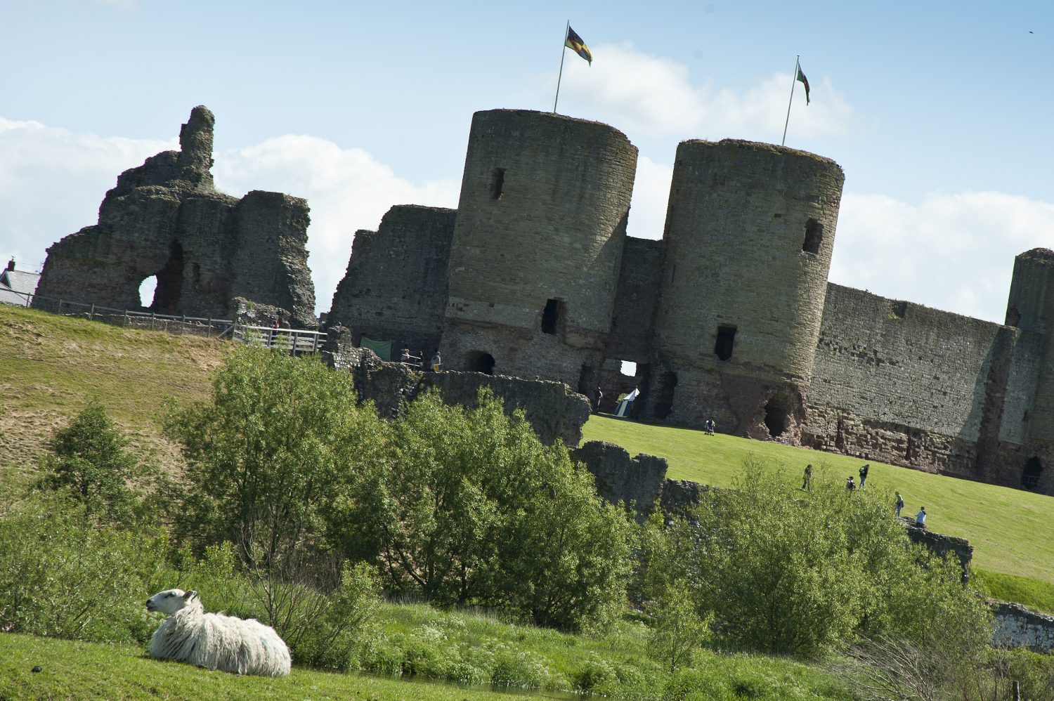
Rhuddlan Castle
Here it is: the glory of the town and one of the great castles of Wales. Begun in 1277, Rhuddlan castle was part of an “iron ring” of fortresses constructed by Edward I in his ruthless campaign to intimidate and subdue the Welsh. Its revolutionary design by master architect James of St George offered three concentric lines of defence – diamond-shaped inner ward, outer ward and deep moat. But there was just one problem. The meandering River Clwyd wasn’t quite in the right place to supply the castle by sea. So Edward, or more accurately a team of 70 conscripted labourers from the Lincolnshire Fens, spent three years diverting it by hand.
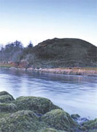
Twthill Mound
Take first right off Hylas Lane to follow signed footpath beside the castle.
The Normans didn’t hang around. Just seven years after the Battle of Hastings, William the Conqueror’s henchman Robert of Rhuddlan built a motte and bailey castle here on top of an old princely palace. The motte, or earthen mound, still stands resplendent beside the River Clwyd. It’s well worth the brief climb up Twthill for a magnificent view which includes the distant spire of Bodelwyddan’s “Marble Church”. The castle changed hands many times over the next couple of centuries before Edward I lost patience and built the immense stone fortress next door.
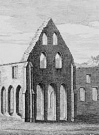
Friary at
Abbey Farm
Detour to the friary by following the footpath south-east. Otherwise retrace your steps.
Llywelyn ap Gruffydd founded a Dominican friary here some time before 1258. It was dissolved during the Reformation but still made a pretty impressive ruin in an etching of 1742. Shortly afterwards Abbey Farm was built on the site – but the friary didn’t disappear entirely. Some of it was recycled. The farm is private but from the lane you can clearly see a 14th century effigy set into the cowhouse wall. A short distance to the east, accessible by footpath, are the remains of the medieval town ditch that protected the friary.
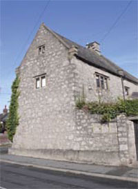
Banquet House
Banquet House is one of the mysteries of Rhuddlan. No one really knows its original purpose – possibly an almshouse. Dating from 1672, it’s a handsome building with two tall storeys, mullioned windows and a carved stone archway over the door. The scout hut near the end of Princes Road is less obviously impressive. But it once stood about a mile away in the rather loftier surroundings of Grade I listed Bodrhyddan Hall (limited summer opening, check at bodrhyddan.co.uk). Mellow brickwork on the gable end is a clue to the days when it rang to the sounds of a wheelwright and blacksmith.
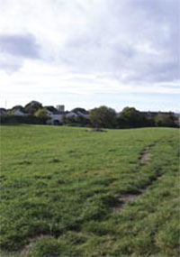
Ditched Defences
As Kerfoot Avenue bends right, take narrow footpath on left.
The grid pattern of Edward I’s town can still be traced in High Street, Castle Street, Church Street, Cross Street, Parliament Street and Gwindy Street. Surrounded by potentially hostile forces, the fledging town needed a circuit of ditched defences, a fragment of which remains visible in this field at the northern edge. It was once a broad water-filled ditch between two ramparts with a timber palisade. Whether it would have been enough to make you feel safe from an army of rampaging Welshmen is another matter entirely. A display board in Gwindy Street will tell you more.